Saturday, 24 October 2009

Easter Island 2


a moai not yet removed from the volcano quarry where it was made


Tongariki moais - 15 in total which have been re-erected


cave we clambered through

There are numerous underground caves near the west coast of the island, previously inhabited by the Rapa Nui, which can be seen from the remainder of many small walls left inside. There are still islanders today who remember times before the arrival of the first aeroplanes. They speak of being brought up in the caves, fetching water daily from the freshwater lake in the volcano crater. They have a history of being persecuted by the people who arrived after the explorers, including Peruvian slave traders who kidnapped many of them and later, a sheep farming company who took over the land surrounding Hanga Roa village, hemming the last of the population in. Many also died when smallpox and TB were brought to the island by continentals. In the 19th century only 111 natives remained. Since 1963, when the island was granted freedom, the population has significantly recovered and modern day life on the island is different to how it was only a generation before. Three aeroplanes daily bring tourists with money to spend in the local community, on souvenirs of hand carved statues and shell necklaces and hiring either cars, scooters or quads to tour the sites. The younger Rapa Nui generation is split between those who remain and those who leave for the continent, although when asked most would admit to wanting to return to the island at some point. There is a strong connection with the ancestral history and culture and a pride in being part of the most isolated community on earth. We explore the caves, amazed at the fact we can walk 200 metres underground through pitch black tunnels. We head back to the pretty beach at Anakena for a last dip in the huge waves of the Pacific Ocean before cooking our last meal in the Mihinoa Camping Hostel and chatting with some fellow travellers who’ve just been to New Zealand and only had great things to say about it.

18.10.09 - 21.10.09 Easter Island (Rapa Nui) - 4,000km off the coast of Chile


The aeroplanes coming to Easter Island have to make a severe descent and be very harsh on the brakes when they land because of the short runway. It runs from one side of the island to the other but still seems much shorter than your average runway. We’re greeted with the customary fresh flower garland and, together with the very warm humidity, we realise we are indeed on a tropical South Pacific island. However, the surrounding landscape appears to be more reminiscent of Fife than Tahiti. The rolling green hills fall away to rocky beaches and there’s no real sign of any tropical vegetation, save for a few palm trees dotted here and there. In fact nettles grow aplenty, including bright purple thistles, which are really bizarre when you see them growing right next to a Moai statue, so many miles from their home country, Scotland.


The island is populated by almost 4,000 inhabitants plus about the same again in horses. They seem to be the preferred livestock, although we can’t work out what purpose they might serve. There are some cows, but no sheep. Kestrels have the skies pretty much to themselves. I’ve seen no evidence of any small furry creatures, like rabbits or rodents and, for some bizarre reason, there seem to be a lot of woodlice. Funny, seeing as one of the main historical issues of the island is that the natives completely deforested it, causing many problems to their sustainment. Nowadays, groves of eucalypts are flourishing along with generic deciduous and they’re attempting to re-introduce the Toromiro tree, which is currently extinct in the wild and was one of the species which suffered from the heavy handedness of the Rapa Nui.


We hire a Daihatsu Terios to tour the island for our 3 day stay and soon realise that the distances on the map are much shorter than they look. It’s possible to drive the full length of the island in just over 20 minutes- 20kms. We start out on the road to the eastern coast, which is a secondary road with many potholes. Greg’s driving gets increasingly more skilled as he becomes adept at navigating through them. We follow the morning tour bus as it makes it’s stops to view the toppled Moai and Ahu (platforms). We soon appreciate however that there are sites which the tour bus either can’t make it to or doesn’t have time on it’s schedule, so it is possible to be the only ones looking at these ancient monuments.


Rapa Nui was discovered by a group of Polynesian pioneers (possibly from the Marquesa Islands, 1,500km to the west) attempting to form a colony and harvest the land. It is unknown exactly when this was but it could’ve been any time from the 8th century to the 14th century AD. They developed into a strictly spiritual culture who built large stone statues, Moai, as gifts to appease their gods. As the years passed these Moai became larger in size, such were the workers pressed by the Akiri, or king of the island, to supersede the previous examples. Unfortunately, for the Rapa Nui, this stone carving culture became obsessive, to the detriment of all else on the island, including the population’s ability to feed itself. Logs were required for the gigantic statues to be rolled into position, so all the trees were cut down. Farmers were conscripted to join the ranks and help with the building, letting their crops go to waste and die, and the whole situation got to the point where it was critical that they alter the way they were living or they would not survive. A new idea came in the form of the Birdman cult, wherein, at the beginning of Spring, when the migratory Sooty Tern would come to nest on the tiny islands of the south coast, the strongest swimmers of each tribe on the island would have to attempt the harsh Pacific waters to collect the first egg of the season. This feat represented fertility for the coming season, and would determine who would be crowned Birdman for the next year, but again caused the virtual extinction of the birds on the island because of the destruction of their nests and their habitat. So, the essence of the Rapa Nui people was the lack of respect they had for the delicate ecosystem of their island and the mass destruction they caused of it. But, it can be said that the majority of the peoples believed that what they were doing would lead to problems, however, they were ruled by the Akiri who frightened them into expending all their energies in the quarries chipping and carving at the rock, to make the biggest Moai ever seen. He told them stories that every other land mass in the ocean had sunk due to lack of belief in the gods and, if they were not careful, their island would sink too. It must’ve been a strange feeling to think you were the only people in the world, not knowing whether anything else was beyond that endless horizon of nothingness.


This isolation also kept them safe however and it was only when explorers and missionaries came to the island in the 18th century that a lot of the population was lost to smallpox and TB.


We can recognise most of the inhabitants of the island’s only village, Hanga Roa, as being directly descended from the Rapa Nui, from their facial features and habit of growing their fuzzy black hair very long. An official Rapa Nui language is still spoken and they take their cultural identity very seriously.


We are impressed by the Moai design, each one in it’s own way, different from the last, and also by the natural beauty of the island with it’s volcanic rock formations and crashing turquoise waves of the vast Pacific.

15.10.09 - 16.10.09 Santiago de Chile


images from the exhibition we visited- 'Inca' products and Catholicism issues.


great fountain at one of the city's parks


view of Santiago from the top of the funicular

Santiago is wealthy with trendsetters and well-dressed business people taking the lead. The city is built up but has also very successfully retained it’s green spaces, which are constantly patrolled by guards to prevent any undue behaviour. We become aware that the parks tend to generally be used by young couples smooching on benches, out of the condemning gaze of their parents most probably. The parks are very pretty, particularly the Santa Lucia city park which has a magnificent fountain and tower esplanade from where a great view of the city can be enjoyed. We also take a trip up the funicular railway to one of the city’s hills, upon which sits an immense statue to the Virgin Mary and an open air church with wooden pews, where a very atmospheric mass must take place every Sunday. There is much evidence of Catholicism still playing a very important part in peoples’ lives in Chile and, in fact, in all the South American countries we’ve visited. We take in a revealing exhibition at the contemporary wing of the Belles Artes Museo in which new South American painters addressed issues of sexuality alongside Catholicism, plus there was a display of Inca-related product packaging. In other words, the artist has collected as many product advertising using ‘Inca’ as a brand name to emphasise quality, which is highly amusing to us.


And this ends our South American adventure. We’re off to Easter Island tomorrow, leaving behind the Latin American peoples, histories and cultures we’ve encountered here, to taste some island living, then it’s on to the down under, English speaking nation of New Zealand!

14.10.09 La Serena


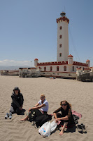
Nell, me and Tristan sitting on the beach at La Serena

La Serena sits on the Pacific coast, a colonial town with the traditional tree-lined boulevard down through the centre of town to the sea and a pretty Plaza des Armas. Our hotel is an eccentric blast from the past with furniture and fixtures from the 1950s, owned by a lovely 90 year old lady who sits placidly at the reception, chatting with her employees. The town itself is very quiet, apart from the packs of trendy school girls who always attempt a “Hello, how are you” to us, practising their English, through endless giggles.


Our tour’s nearly over and it’s only 7 hours to Santiago, our final stop.

12.10.09 - 13.10.09 San Pedro de Atacama (Atacama Desert) Chile


As soon as we cross the Chilean border we notice a difference in levels of wealth between the two countries, Bolivia and Chile. The Chilean road leading through the desert in front of us is fully tarmac, with painted lines and the occasional signpost, whereas the Bolivian roads we’ve just left were dirt tracks at the best of times. The Chilean border control officers are super smart in their co-ordinated uniforms and the border control building itself is contemporary in design and looks pretty much brand new. In comparison the Bolivian border office was a small hut in a dusty field where all the tour jeeps were parked up higgledy piggledy with tourists’ bags strewn all over the ground ready to be searched.
San Pedro is the first town reached after the Bolivia/ Chile border and reinforces the idea that we’ve arrived in a completely different country. In fact, Chile is what they call, the success story of South America. It is the most economically advanced, the most European in nature and, to follow suit, the most conservative of South American people live here. This is evidenced in San Pedro when we discover loud music and dancing are strictly prohibited here, even though it is one of the most popular tourist towns in the country, due to its location in the Atacama desert, within easy reach of the Bolivian Altiplano and the striking desert valleys of the Moon and Mars. It is entirely constructed in adobe brick, but not because this is the only material that can be afforded. The artisan community have preserved the original nature of the town and any new hotels or restaurants built must retain the same low rise design using adobe.
We have the opportunity to explore the mud hills of the Valley of Mars, just outside the town- bizarre formations which prove to be a fun mud playground, before heading off to our penultimate destination La Serena.

Tuesday, 13 October 2009


typical Altiplano scenery

one of the hundreds of pink, smelly flamingos
geysers and hot pools

After breakfast on the second day we journey out into the Altiplano which proves a much rougher ride in our 4x4s than the salt flats. There are no paved roads, only dirt tracks and some of the routes we take off road are evidently too much for our vehicle as we stall going up a deep sand hill and unfortunately the engine gives up. Our driver and his two driving buddies spend a good half hour investigating under the bonnet and, it turns out, one of the belts has gone. It’s lucky our drivers are trained mechanics because the umpteen times our truck fails, they always seem to be able to get it running again.
I have a day of firsts- my first view of an active volcano, spewing clouds of steam, and my first encounter with hundreds of pink flamingos on the Laguna Colorado.
They are elegant creatures gently stalking their way through the shallow waters, bending their long necks to feed. However they are smelly and the spongy ground around the edge of the lake seems to be made of a mixture of soft earth, sulphur and bird poo.
We visit a couple of other mineral rich lagunas before reaching our next accommodation, which, again is very basic. Now we are pretty desperate for a shower because the sandy plains we’re driving through throw up a lot of dust which gets through even the pollen filters in the car’s air vents, and we end up coated in the stuff.
The accommodation block is located on the banks of the Laguna Rojo (Red Lake) which gets its colour in fact from the red algae growing in it, not from any minerals present. We take a windy walk round the edge to a viewpoint, uncertain whether the white rocky formations on one side are, in fact, the remnants of a glacier. They certainly look like ice and its extremely cold- overnight temperatures can reach as low as -20 degrees Celsius.
The following day we continue on our epic road trip through the endless empty plains of the Altiplano, rising at an unsociable 4.30am, in order to make it to the Geysers of Tatio for sunrise.
As we get there the sun’s rays are slowly penetrating the volcanic hillsides but the temperature remains below freezing and I can’t remember the last time I was this cold. The geysers and bubbling sulphurous pools are very active at this time of day and the plumes of gas emitting from them catch the morning light giving the place a ghostly feel. We are free to wander between pools on narrow ledges and its only after we leave the area I find out the water can reach 85 degrees Celsius and it’s quite dangerous.
We stop at a hut for breakfast by the side of a lake with a hot springs pool in it, before heading to the Bolivian/ Chile border control and on to our next destination, San Pedro de Atacama (hot showers await!)

Bolivian Altiplano Road Trip 09.10.09 - 11.10.09


the Bolivian salt flats- a strange white environment


cactus on the 'coral' rock island


one of our 'scale' illusion photos
The Bolivian Aliplano (high plains) is an area of inland drainage, at an average altitude of 3,750m above sea level. Originally, in the Pleistocene epoch, the entire area was covered by a giant lake, the present remnants of which are the freshwater Lake Titicaca, the salt lake Poopo and the Salar de Uyuni (salt flats of Uyuni). The Altiplano is flanked by two Cordillera mountain ranges and, to the south lies the Atacama desert and to the east lies the Amazon rainforest. It is thought that the ranges on either side helped to trap the sediment of the lakes and form the unique, flat landscape of the Altiplano. The whole area is volcanically active with evidence from the immense variety of geological rock formations, mineral rich lake waters and hillsides containing a myriad of colours from the different stones.
We leave Uyuni in 4x4s for the 3 day salt flat/ Altiplano tour, first stop the bubbling salt water pools which replenish the white salt crystals covering the entire plain, through evaporation. The salt crunches like snow under our feet and, along with the vast sparkling whiteness, it’s reminiscent of a winter landscape, the main difference being the temperature. We stop next at a ‘coral’ rock island in the middle of the salt flats which is covered in cacti and the heat is almost unbearable. We notice the rock’s porous nature, which indeed is similar to underwater coral reef formations. It was indeed originally below the paleolake, centuries ago.
Our afternoon is taken up by creating weird and wonderful ’scale’ photos in the salt flats. The environment, because it’s so flat and pure white, is ideal for illusions of scale- ie; a plastic toy dinosaur positioned close to the camera lens can appear similar in height to a person positioned 10-15 feet away, if the angle of the lens is correct. Such fun!
Once we’ve exhausted pretty much all possibilities we head off to our accommodation in the Altiplano hillside. It’s very basic, electricity is only available for 2 hours in the evening and we have to share a dormitory which, in fact, is quite fun as we reminisce our times at school camp.

Involvement in Bolivian Road Block- outside Uyuni

On route from Potosi (7 hour bus journey)

our bus disappearing into the distance at great speed

The first we know that we’ve encountered a political road block is when we’re asked to quickly leave the bus with our belongings and walk.


Our poor bus driver, who has been coping with a broken windscreen for the past three hours through dusty Bolivian desert, has to attempt to speed past the oil tanker, which is pushing him, and make a diversion off road through the darkening desert. We are unaware how far he manages to get as we are already trekking our way down the road past numerous oil tankers blocking our path. We tactfully say nothing to the drivers as we pass, in case they are averse to us crossing their protest path.


Seemingly this kind of blockade occurs regularly in Bolivia, but it’s the first time Heidi has ever encountered such an episode with a tour group and she is obviously worried, as she tells us that sometimes they can turn violent and tourists have been known to be seriously injured by drivers throwing boulders as they attempt to pass through. Eventually, after 1 ½ hours walking through a pitch black desert we come upon our destination town of Uyuni, where we ask for directions to the bus terminal, in hope that our big rucksacks, which were in the bus’ boot, are located. However, when we arrive, we are informed our bus never made it and has had to turn back.


The dawning realisation occurs that, although we are glad to have all made it safely to Uyuni, our bags have not.


We eat together at the local pizza joint, still in good spirits and Heidi vows to investigate the situation first thing in the morning.


Next day we are told many stories about the blockade- like, no one is journeying there from Uyuni because it’s too dangerous, there’s a petrol shortage in town and our bus has had to travel all the way back to the previous mining town where it’s tyres have been slashed. However, all of this turns out to be untrue. Our bus is, in fact, stranded with deflated tyres, on the other side of the blockade, which, in fact, disperses at noon and Heidi is able to journey there by taxi to retrieve our bags. At first our hotel was unwilling to attempt the trip because they believed it was dangerous to send gringos out there- they would become a significant target, but they relented and we now have all our belongings back safe and sound. The town of Uyuni is however still at a standstill as numerous tour groups wait till they’re given the go ahead to journey to the Bolivian salt flats.


In the end, everything worked out well, but it could’ve been very much worse.

06.10.09 Visit to Cerro Rico Mines, Potosi


inside the Potosi mines

Greg trying his hand at hammering a hole for the dynamite


the infamous Tio, the undergound god of the miners

Greg preparing his dynamite- just look at his face!

Although the film ‘The Devil’s Miner’ was made over five years ago, we notice that conditions have remained the same for the miners on Cerro Rico mountain. They now work as a co-operative, earning as they find, but there are still accidents every day. We are stunned when, after we disembark from our minibus, we are encountered by Vanessa the little girl from the film, who is now around ten, selling mineral stones she’s scavenged, from a little wooden box. I am devastated when I learn that Basillo, now 19, is still working in the mines. He is also continuing to study, but it is tragic to know that he is still suffering such awful conditions to provide for his family. We buy a turquoise stone from Vanessa and continue up the track to the entrance of one of the mines. We carry with us gifts for the miners of bags of coca leaves, which they chew continuously to numb the pain they endure, biscuits for their kids and… a stick of dynamite! Yes, we were donating dynamite. It’s an expensive, but essential item to them, as they use it to blow up areas of rock surrounding the precious minerals.Greg’s in his element with the prospect of witnessing live explosions underground and the chance to blow up his own stick of dynamite outside, after our tour. We are led into the maze of rocky tunnels lit only by our headlamps. The dust hits us straight away but, unlike the miners who don’t wear masks or helmets for that matter, we are protected from the choking effects of the dust by face masks. The dank, sulphurous smell still gets through however and you get the distinct impression that this toxic environment is not designed for fragile human lungs. We meet a miner who transports tonnes of waste rock out the mine using a wheelbarrow which, in itself, would be dangerous work as there are many deep holes littering the tunnel walkways. He is unsurprisingly chewing coca leaves and we donate more from our stash to him. He works next to the statue of the Tio, which is eerie in this halflight, draped in colourful streamers with cigarette stubs hanging out it’s mouth and hundreds of coca leaves scattered round it’s base. We are led on to meet another miner who is hammering into the rock face in order to insert dynamite. This can take 2-3 hours just to reach the required depth. We are treated to witness the explosion once he has packed the dynamite into the hole and lit the fuse. Of course we wait several metres away from it and, to intensify the anticipation of the boom, we turn our headlamps off and sit in complete darkness. It’s loud, when it eventually comes, and we can feel the vibrations through our seats. We thank the miners with gifts and move on, through the tunnel maze, which, as we get deeper and further away from the entrance, feels more and more claustrophobic and thoughts of what would happen if there was a collapse and we couldn’t get out start to enter our minds. We needn’t have worried however because round the corner we see light at the end of the tunnel and the way out. It is a sobering thought however that many of these men work 14 hour days, 7 days a week, underground where there is no light, no reference to the outside world, and face the constant risk of dying from lung failure or being involved in an accident. We recover from the tour, breathing in fresh air and chatting with some of the miners’ wives who live just outside the mines, then the highlight for Greg- the chance to set off his own stick of dynamite. We drive to an empty part of the mountain and Greg and Mark prepare their explosions. We wait at the viewpoint as they hurry back, having lit the fuses. The boom is huge, a visible sound wave moves across the valley and a huge cloud of smoke immediately rises 20 feet tall. Greg jumps around, delighted as a little kid would be setting off his first banger!

Thursday, 8 October 2009

The Story of Basillo, ‘The Devil’s Miner’ (a documentary film watched prior to visiting Cerro Rico)


Basillo was ten years old when he started working in the silver mines of Cerro Rico, a mineral rich hill which shadows the town of Potosi. His father was dead so he had to step in and provide for his mother, younger brother and baby sister Vanessa. They lived next to one of the entrances to the 5,000 mines which riddle the mountain, in a tiny adobe shack. He worked long hours as an assistant, carrying the loose rock and helping the other miners hammer into the mineral veins in search of precious metals. The dust inside the mines causes miners to develop silicosis in the lungs and their average lifespan is only 35. Basillo worried about this and his little brother, who also worked alongside him. They were scared that they would die in the mines, accidents happened everyday. There were collapses in the tunnels and often fatalities due to problems with the dynamite explosions they used for revealing the minerals. A startling statistic of 8 million fatalities on the Cerro Rico mountain alone since it was first mined, shows the extent of the dangerous conditions the miners face on a day to day basis.
An odd, but understandable tradition of blessing a devil god in the mines is still practised today. This devil icon was introduced by the Spanish when they enslaved the indigenous population into working for them in the mines. They saw that the people were frightened of dying underground, where god doesn’t seem to exist, and introduced a devil figure to ‘protect’ the miners from harm.
Every miner, including Basillo and his brother, bring gifts of coca leaves, alcohol and cigarettes to the Tio (the devil god as it’s called) in order that he will look after them in the mine and not let any harm come to them. Although the boys are too scared to look right in the Tio’s face, they are comforted by the belief he will protect them.
Basillo and his brother used what little money they brought into the household to buy food and save for the coming year’s school uniforms. Their mother believed education was the key for them to leave working in the mine and achieve better things for themselves. Basillo had dreams of becoming a teacher and his brother a civil engineer. They attended school in Potosi in the mornings before starting their shifts at the mine in the afternoon. At the age of 14, Basillo is recorded to have said he wishes to only work five more months in the mine before seeking better paid employment in the town, where the lifestyle is healthier for him and his family.

La Paz (commercial capital) and Sucre (political capital) - A Comparison


fiesta of the Virgin Rosario, La Paz
La Paz sits in a bowl shaped valley, high in the Bolivian Andes and has a claim to fame of being the highest capital city in the world, at 3,600m above sea level. It’s sprawling mass covers the surrounding hillsides with endless adobe brick built apartments. It’s a poor city, evident from the state of the buildings and the numerous markets, selling everything from plastic containers, jeans and other fashion clothes, to hardware and toiletries. The nearest supermarket is in a local suburb, a taxi ride away from the centre. Although, in the UK, we view supermarket shopping as the cheapest, here the imported goods in supermarkets are generally too expensive for the average salary and the street stalls of the city boast much more reasonable prices and more selection.
It’s obvious that Bolivians love to celebrate, from the endless shops specialising in masks, cardboard cakes and hats, streamers and confetti. Again, a contradiction in that the more hard up people are it seems the more they plough whatever money they have into fiestas and carnivals. We are ‘fortunate’ to be staying at Hotel Rosario and it just so happens that the celebration of the Virgin Rosario is taking place directly outside our hotel on the very weekend we are here. Music is pumped out in the street till 2am each night and people either crowd round the stage watching the various live acts or set up camp on wooden benches with crates of bottled beer to hand.
On the day we leave a procession takes place through the city streets, starting at our hotel. The brass band, playing traditional Bolivian tunes, leads the way, followed by a girl in gold platform boots twisting her way along in a skimpy gold lame minidress. Making their skirts twirl in sync are many groups of indigenous women dressed in identical striking colourways and following them are bizarre, holographic ‘armoured’ men with crazy masks and bright red and white feathers coming out of their heads. This spectacle would be enough in itself without the added bonus of simultaneous dance steps, bringing the whole occasion to life. I can see why so many local people come here to take in this amazing display in an otherwise drab brown city.
Sucre, by comparison, is the political capital of Bolivia, meaning it houses the parliament buildings and is where the current government sits. It’s much smaller than La Paz but outweighs it tenfold in the beauty of it’s architecture. It’s pretty, cobbled streets are lined with colonial whitewashed buildings, each with it’s features well-preserved. On each corner of the main square there are extensive newspaper stands, which is unheard of in La Paz (no-one seems to read anything apart from sensationalist tabloids). And the newspapers in Sucre are intellectually sound.
Small food and drink kiosks in La Paz are ‘replaced’ by comprehensive stationers and book shops in Sucre. It’s possible to tell that the inhabitants of Sucre are more wealthy than La Paz, due to their choice of clothing (more westernised) and more in keeping with current fashions. The funny thing is though that I don’t find these people half as visually interesting as the charismatic, crumpled but still smiling faces of the variety of local peoples in La Paz. And I wonder whether the people of Sucre would be as much into the fiestas and celebrations as the people of Paz?

02.10.09 The Most Dangerous Road in the World - La Paz


‘Downhill Madness’ Cycling Tour
The most dangerous road in the world, otherwise known as ‘Death Road’ has, in the past, claimed the lives of over 100 people per year, due to its narrow, winding switchbacks and sheer drops. It starts at 4,640m in the snowy landscapes of the mountain tops and descends 3,345m, through cloudy rainforests to the hilltop town of Coroico. Nowadays a new alternative road, wider and safer, is more heavily used by traffic, but today construction work on one of it’s bends, caused an unusual amount of traffic to use the Death Road, which only contributed to our obstacles. The first quarter of the ride was smooth-going asphalt and some of the guys in our group including Greg, reached speeds of up to 55kmh. Then it turned to loose gravel and the fun started!
Our mountain bikes were top of the range with full suspension rigging on the front and back wheels. But, even so, it was a bumpy ride, navigating boulders and ruts especially when the road was narrow and there was a long drop on one side. I couldn’t help my imagination running wild at times, thinking what would happen if I hit that stone wrong! A picture of Nicky when he broke his wrist falling head first over his handlebars just wouldn’t go out of my head! Greg was very kind to rein in his desire of an adrenalin rush and stayed at the back of the group with me. At times I would pick up speed and do really well without thinking, then suddenly remember that only in May of this year a cyclist doing just what I was doing lost their life over the edge, and I would pull harder on the brakes and take it easier.
We covered about 47km all pretty much downhill and, by the time we reached the hotel where we were having lunch, I’d developed aching knees, with the intense vibrations from the rocky road, a sore bum from bouncing around on the bicycle seat and tenderness in the palm of my right hand from having my fingers clutching the brake constantly.
However, despite this, the trip was well worthwhile- the scenery alone was spectacular. We were descending through cold alpine mountains which turned into humid tropical cloud forests with dozens of butterflies and colourful birds. At the end of the day, we could say we’d survived the most dangerous road in the world.

Saturday, 3 October 2009

Amarantani Island Homestay


Inocencia's house

guinea pigs living behind the stove- with no refrigeration, it's important to make sure your food's fresh!

Inocencia and me in traditional costume, in Greg's and my little bedroom

On arrival at Amarantani port we are introduced to our new homestay ‘mothers’ who will look after us, cook for us and allow us into their homes for the night. Our Mama’s name is Inocencia and she has a 14 year old daughter Marie. Her house is designed round a small cobbled courtyard with bedrooms and storerooms on three sides, a kitchen out back, which is separate to the house and an outdoor toilet at the end of the donkey run. We notice light bulbs but she explains in Spanish that there’s no electricity. She speaks Quechua with her daughter and we try our best to communicate what little we can in Spanish. Our room is cosy and at least the walls are plastered, not just plain adobe brick. We wait in our room for lunch, not sure how to go about helping. She exclaims she needs none and brings us hot soup and potatoes with cheese, which we struggle to get through, there’s so much. I take a tour of the house with the video camera, pointing out the squeaking guinea pigs who live in the alcove behind the log stove. I secretly hope they’re not on the menu tonight. After almuerzo, Inocencia escorts us, in her fully embroidered traditional dress, up to the village’s soccer pitch, where the majority of our tour party get rid of some of their nervous energy in a short game of 6 a side.
Each pair in our party, has been allocated a homestay family and we all chat about how welcomed we’ve been made to feel in these poor people’s homes. Homestay, as a practise on the island, has been going on for ten years and, I figure, it must make economic sense to the families and they seem to genuinely enjoy it. Heidi says we all look so odd to them and in order that they can distinguish us from the next white westerner we are given the family beanie to wear. After footy, our ‘mothers’ lead us home for tea. We are invited to eat in the cocina (kitchen) with Inocencia and Marie, where it’s considerably warmer than in our little bedroom. A different soup with keenwa and several potato types is followed by a vegetable stew with rice and coca tea. The diet is good her, all home grown produce from the farming terraces surrounding Inocencia’s home. Marie sits by the candlelight knitting a yellow cardigan, occasionally requiring advice from her mother. She tells us she speaks three languages, Quechua, Spanish and is learning English at school on the island. I can’t help but wonder if she’ll remain on the island when she grows up, where day to day life is hard or choose to pursue a career on the mainland. Inocencia actually grew up in Lima but it is a testament to life on the island that she made the decision to return here to live with her parents in this house.
We are dressed up by Inocencia into traditional costume of the island and escorted to the panpipe disco where all the visiting gringos are ‘forced’ to participate in lively dancing.
After a sound night’s sleep Inocencia presents us with a super breakfast of pancakes and coca tea. There’s no such thing as a shower or bathroom here so it’s a quick baby wipe wash and brushing of teeth outside the garden gate.
It’s not long before we are making our way down to the port of Colcacacha village and saying our goodbyes.
Our first taste of homestay accommodation has been an extreme one, but very enjoyable. On our way back to Puno we stop off at Taquille Island where the descendents of the Pre-Inca culture Tiahuanaco live off the land. It is a beautiful day and the sun sparkles on the turquoise blue of the lake, making us all feel like we’re on holiday.

29.09.09 Lake Titicaca Homestay


floating reed islands of the Uros Indians- Lake Titicaca

After recovering physically from the Inca Trail and mentally making peace with the fact our trip to one of the seven wonders of the world is over, it’s on to Puno and Lake Titicaca, the highest navigable lake in the world. Lake Titicaca is 8000km long by 200km wide and, as we crawl over the crest of the hill behind Puno on first sight it’s more a vast ocean than a lake. Our seven hour bus journey here took us through more low lying Andean scenery, relatively unpopulated plains of barren land. We are however only 200km from the beginnings of the jungle and not far, in the other direction, from the stiflingly hot deserts. Lake Titicaca was formed when the tectonic plates which made the volcanic Andes rose up and the ensuing sea water filled the troughs they created. The water has now turned fresh since the salts and minerals it once held were washed down with the force of many in-flowing rivers and now the remnants form the famous Bolivian salt flats. Lake Titicaca takes it’s name from Titi in Quechua meaning puma, and caca meaning rock. There are many Quechua legends surrounding the lake and its native island peoples and one was that there was a huge battle between the pumas from the hills and the native tribes which, in the end, forced the people to settle on the islands for safety.
We visit the Uros Indians who dwell on floating islands made purely of Torturo reeds. I have never seen anything like it. They have lived for centuries on these islands which they construct from the root system of the reeds bound together with rope and layers upon layers of reeds are placed on top to form a spongy floating platform. An island has a lifespan of only 15 years before it begins to disintegrate and the inhabitants have to set about constructing a new one. Their reed cabins can be transferred to the new island easily as they are constructed atop reed rafts. Everything needed for survival is on the island, the men fish and the women prepare the food in small stoves. They journey to the main land on their traditional reed boats to trade fish with the locals for other produce not available to them- maize, corn, potatoes, rice. We are told that, due to genetic problems arising owing to significant interbreeding within the Uros Indian population (of which there are 1,300 across 36 islands) many of the younger generation opt to find partners on the mainland, either choosing to stay or return to island life.
It is fascinating but we must leave to sail to Amarantani Island to meet our homestay families.